How to resolve AdBlock issue?
 - Elizabeth Larson
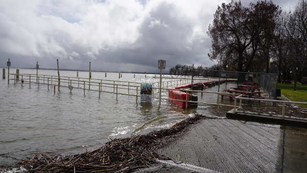
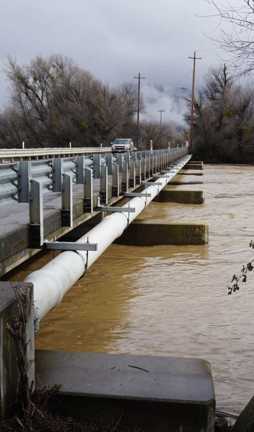
Clear Lake hits flood stage; portions of local highways, roads, Library Park flooded
LAKE COUNTY, Calif. – Days of steady rain from an atmospheric river storm have pushed Clear Lake into flood stage, with portions of two state highways, numerous roads and Library Park in Lakeport now flooding due to the excess water.
For Clear Lake, flood stage is 9 feet Rumsey – the special measure for the lake – and above. As of 1 p.m. Wednesday, Clear Lake was at 9.28 feet Rumsey and continuing to rise, according to the California Department of Water Resources’ Data Exchange Center.
The rainfall and water bodies draining into Clear Lake and other local water bodies led on Wednesday to flooding across Highway 20 near Witter Springs. As a result, Caltrans and the California Highway Patrol closed Highway 20 at the roundabout at the junction with Highway 29 in Upper Lake to Highway 20 at Potter Valley Road in Mendocino County.
Caltrans reported that Highway 175 to Hopland is closed from the junction of Highway 101 to just over half a mile east due to flooding.
Numerous county roadways also have been covered by flood waters, necessitating closures which are listed below.
County of Lake officials advised residents living on or near Clear Lake to be prepared for flooding, as the California Nevada River Forecast Center is forecasting 3.5 inches of rain for the Clear Lake watershed through Saturday.
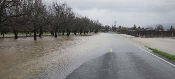
The new rainfall that’s expected is on top of large amounts of rain recorded over the past three days, ranging from 5 inches near Lakeport to 10 inches near Bartlett Springs and estimates of nearly 15 inches in parts of Cobb.
The lake is projected to reach 9.8 feet Rumsey late Thursday night, holding there before starting to drop by Sunday, according to the California Nevada River Forecast Center.
County officials said the north shore of the lake will be susceptible to wave action as strong southerly wind gusts are expected. High lake levels are expected for a prolonged period.
A substantial amount of debris also has washed into the lake, with local officials reporting that trees, docks and appliances have been observed floating on the surface. They urge boaters to use caution and be aware that a mandatory idle speed limit is in effect when boating within one quarter mile of the shoreline.
The city of Lakeport on Wednesday morning closed Library Park due to flooding. The park’s docks had been raised in some areas and removed in others, with water coming over the seawall – damaged from the 2017 storms – and flooding the areas around the picnic tables.
Along Lakeshore Boulevard in Lakeport, piers and docks were covered by water and tules were washing up against the roadway. A city Public Works crew was in the middle of the road on Wednesday morning, fixing potholes.
County officials said a portion of Soda Bay Road is closed but they’ve been able to open the road from Big Valley Road to Highway 175 and South Main Street. Drivers are urged to watch out for debris.
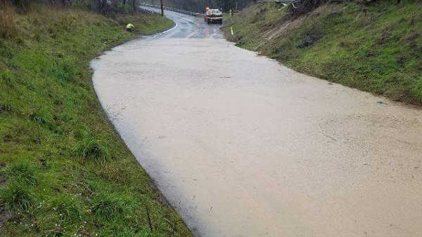
Highland Springs Road remains open despite a mudslide at mile post marker 5.5.
Road closures and special notices about speed and conditions as of 5 p.m. Wednesday are listed below, according to the Lake County Public Works Department, the CHP, Caltrans, and the cities of Clearlake and Lakeport.
Since the last update earlier in the afternoon, new closures were implemented on Stokes Avenue in Nice and Rose Anderson Road in Middletown, Argonaut Road was reopened between Big Valley Road and Thomas Drive, and Finley East Road was reopened from Cal Packing Road to Stone Drive.
CLEARLAKE
13451 Lower Lakeshore Drive to 13544 Lower Lakeshore: Closed due to flooding.
HIDDEN VALLEY LAKE
Spruce Grove Road Extension: Closed near USS Liberty Lane (Quarry Road) due to road slipout.
KELSEYVILLE
Bell Hill Road: Closed at Adobe Creek low water crossing due to flooding; closed from Main Street to Highway 29.
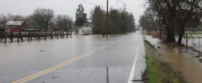
Big Valley Road: Flooded in multiple locations. Road is open at this time, please reduce speeds.
Clark Drive: Closed from Soda Bay Road to Gaddy Lane due to flooding.
Konocti Bay Road: Mudslide blocking one lane near Richmond Park.
LAKEPORT
Esplanade Street: Closed due to flooding.
Highland Springs Road: Mudslide at mile post marker 5.5, however, road still open.
Hill Road: Single-lane traffic from Lakeshore to Sutter Hospital. Traffic will not be able to drive from Sutter Hospital to Lakeshore Boulevard due to slide movement.
Matthews Road: Multiple small mudslides, road is still open and passable.
Scotts Valley Road: Closed from Highway 20 to packing sheds due to flooding.
Soda Bay Road: Closed from Stone Drive to Cal Packing Road due to Adobe creek jumping the bank and flooding the roadway.
LOWER LAKE
Anderson Road: Mud/debris slide blocking the roadway.
Candy Lane: Closed to all traffic between Joseph Trail and May Hollow Road due to a culvert failure. This will be an extended closure as work to fix cannot commence until the water stops flowing.
MIDDLETOWN
Big Canyon Road: Closed to all traffic at MPM 7 due to Mudslide. Closure will run from Ettawa Springs road to Harbin Springs. Affected property owners will be allowed access to and from their property.
Dry Creek Cutoff: Closed at the low water crossing.
NICE
Lakeshore Drive: Closed from Stokes Avenue to Hammond Avenue due to flooding.
Rose Anderson Road: Closed to all traffic at Van Dorn Reservoir Road due to road slipout.
Stokes Avenue: Closed at Nice-Lucerne Cutoff due to flooding.
UPPER LAKE
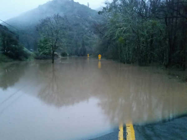
Laurel Dell Road: Closed from Scotts Valley Road to Mid Lake Road due to flooding.
Mendenhall Road: Closed from Highway 20 to Main Street due to flooding.
Scotts Valley Road: Closed from Highway 20 to packing sheds due to flooding.
Witter Springs Road: Closed from Highway 20 to East Road due to flooding.
Weather, flood and road information is available from the following sources.
National Weather Service Sacramento
http://www.weather.gov/sto
Lake County Public Works Road Division
http://www.lakecountyca.gov/Government/Directory/Public_Works/Divisions/Roads.htm
Lake County Water Resources Department
http://www.lakecountyca.gov/Government/Directory/WaterResources/HydrologicLinks.htm
Lake County flood and road information
http://www.lakecountyca.gov/Government/Directory/WaterResources/FloodPreparation.htm
Caltrans Highway Information
http://www.dot.ca.gov/cgi-bin/roads.cgi
City of Lakeport
https://www.cityoflakeport.com/
City of Clearlake
https://www.clearlake.ca.us/
Email Elizabeth Larson at