 How to resolve AdBlock issue?
News
- Details
- Written by: Elizabeth Larson
NORTHERN CALIFORNIA – A gray wolf that crossed the Oregon border into California late last year has traveled farther down the state, arriving in Butte County.
Known as OR7, the 3-year-old wolf was first tracked by satellite in Butte County on June 28, according to an update from the California Department of Fish and Game.
The agency said it intentionally delays updating maps on OR7’s movements to protect his current location.
A Monday update said the wolf was in northeastern Butte County.
OR7 was born in spring 2009 in northeastern Oregon, the Department of Fish and Game reported.
He grew up as part of the state’s Imnaha pack, which was first documented the year he was born in the Imnaha River drainage, east of the communities of Enterprise and Joseph in Wallowa County. Officials reported that the pack’s founding members migrated to Oregon from Idaho.
OR7 was collared with a radio transmitter by Oregon Department of Fish and Wildlife (ODFW) in February 2011, about nine months before officials said he dispersed from the Imnaha pack.
He headed south, traveling hundreds of miles and crossing Interstate 84 and several highways before passing into California near Dorris in Siskiyou County on Dec. 28, according to the California and Oregon wildlife agencies.
His appearance in California is the first of any wild wolf since 1924. That year, the last gray wolf was killed in Lassen County, the state reported.
Since then, tracking has shown he’s traveled an average of 15 miles a day through a variety of habitats and predominantly on public lands.
He was spotted in May in Modoc County by state and federal wildlife officials.
Email Elizabeth Larson at
- Details
- Written by: Elizabeth Larson
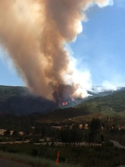
NORTHERN CALIFORNIA – A fire burning since Saturday on the Colusa County side of the Mendocino National Forest has continued to grow, reaching an estimated 2,500 acres by Monday.
The Mill Fire – burning near the Mill Creek Campground, north and east of Upper Letts Lake – showed significant growth on Sunday, according to a Mendocino National Forest report.
On Monday morning, Northern California Team 2, a Type 2 Interagency Incident Management Team, assumed command of the Mill Fire. The team is based in Stonyford.
The fire was 10 percent contained on Monday, according to the forest officials.
The cause remains under investigation.
Forest officials reported that the fire's growth has been driven by hot, dry conditions, with growth taking place predominately to the east and north. It's burning in timber and brush.
The Mill Fire's behavior has shown active torching, crown runs and spotting up to one half mile in advance of the main fire, according to the report.
With the weather conditions forecast for the rest of this week temperatures between 90 and 95 degrees and low relative humidity between 9 and 16 percent – officials are concerned that firefighters will be met with additional challenges.
On scene Monday were nine Type 1 crews, three Type 2 crews, eight helicopters, 17 engines, four dozers, two water tenders and a total of 360 personnel, according to the incident management team's report.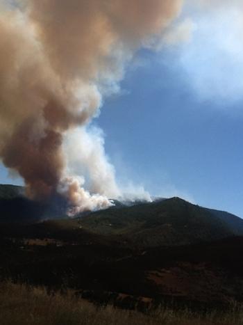
The communities of Fouts Springs, Bonnie View and Board Camp Springs and campgrounds within the Upper Letts Lake area remain under evacuation order, incident command reported.
Portions of the community of Stonyford are under voluntary evacuation, and officials reported that an advisory has been issued to residents west of the Stonyford Lodoga Road between Stonyford and Goat Mountain Road to be prepared for a possible evacuation
Road closures include Fouts Spring Road (The M10 Road) at Stonyford and Goat Mountain Road at Stonyford Lodoga Road, officials reported.
The incident management team will hold a meeting at the Stonyford Grange at 7 p.m. Monday, at which time the team and Mendocino National Forest officials will provide updates and new information on the incident.
Email Elizabeth Larson at
- Details
- Written by: Elizabeth Larson
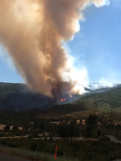
NORTHERN CALIFORNIA – A fire burning since Saturday on the Colusa County side of the Mendocino National Forest has continued to grow, reaching an estimated 2,500 acres by Monday.
The Mill Fire – burning near the Mill Creek Campground, north and east of Upper Letts Lake – showed significant growth on Sunday, according to a Mendocino National Forest report.
On Monday morning, Northern California Team 2, a Type 2 Interagency Incident Management Team, assumed command of the Mill Fire. The team is based in Stonyford.
The fire was 10 percent contained on Monday, according to the forest officials.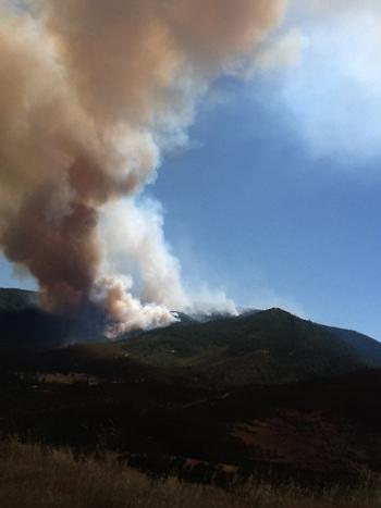
The cause remains under investigation.
Forest officials reported that the fire's growth has been driven by hot, dry conditions, with growth taking place predominately to the east and north. It's burning in timber and brush.
The Mill Fire's behavior has shown active torching, crown runs and spotting up to one half mile in advance of the main fire, according to the report.
With the weather conditions forecast for the rest of this week – temperatures between 90 and 95 degrees and low relative humidity between 9 and 16 percent – officials are concerned that firefighters will be met with additional challenges.
On scene Monday were nine Type 1 crews, three Type 2 crews, eight helicopters, 17 engines, four dozers, two water tenders and a total of 360 personnel, according to the incident management team's report.
The communities of Fouts Springs, Bonnie View and Board Camp Springs and campgrounds within the Upper Letts Lake area remain under evacuation order, incident command reported.
Portions of the community of Stonyford are under voluntary evacuation, and officials reported that an advisory has been issued to residents west of the Stonyford Lodoga Road between Stonyford and Goat Mountain Road to be prepared for a possible evacuation.
Road closures include Fouts Spring Road (The M10 Road) at Stonyford and Goat Mountain Road at Stonyford Lodoga Road, officials reported.
The incident management team will hold a meeting at the Stonyford Grange at 7 p.m. Monday, at which time the team and Mendocino National Forest officials will provide updates and new information on the incident.
Email Elizabeth Larson at
- Details
- Written by: Elizabeth Larson
NORTHERN CALIFORNIA – A wildland fire complex that began burning in neighboring Colusa County on Sunday had burned an estimated 3,700 acres by Monday morning.
The five-fire Sites Complex – reported at about 4 p.m. Sunday – is burning between the town of Sites and East Park Road, according to a Cal Fire update.
Cal Fire said the fires are burning in grass, brush and grassy oak woodland.
Five structures – outbuildings on rural properties – are threatened, according to Cal Fire.
On Monday morning firefighters had achieved 40 percent containment on the complex, with Cal Fire estimating full containment will be reached at some point on Thursday, July 12.
Approximately 1,145 firefighter personnel were working the complex on Monday, along with 42 engines, 16 dozers, 144 overhead or command positions, 10 water tenders, three helicopters, four air tankers and one air tactical.
The cause of the fires so far has not been reported.
Email Elizabeth Larson at