 How to resolve AdBlock issue?
News
- Details
- Written by: Elizabeth Larson
THIS STORY WAS UPDATED AT 7:45 P.M. WITH A NEW ACREAGE ESTIMATE.
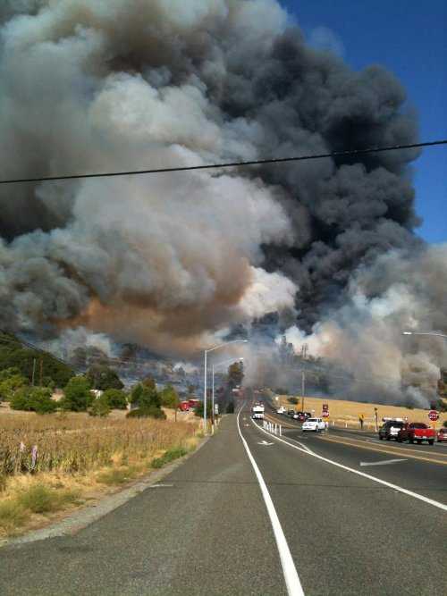
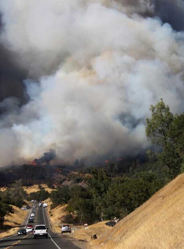
CLEARLAKE OAKS, Calif. – Two fires that began burning along Highway 20 Sunday afternoon had burned thousands of acres by evening.
The “Wye” Fire – named for the “Y,” the nickname for the intersection of Highway 20 and Highway 53 – was reported shortly before 4 p.m. and by 7 p.m. had ballooned to about 3,000 acres, according to Cal Fire Battalion Chief Julie Hutchinson.
Within an hour, the Wye Fire was up to 5,000 acres, Cal Fire reported.
“It is burning on both sides of Highway 20 and it’s burning in an easterly direction toward the community of Spring Valley,” Hutchinson said.
Hutchinson said the Spring Valley evacuations were mandatory.
No injuries were reported, but one structure had been destroyed, she said.
Shortly before 8 p.m. the California Highway Patrol reported that about 30 vehicles were being escorted out of Spring Valley.
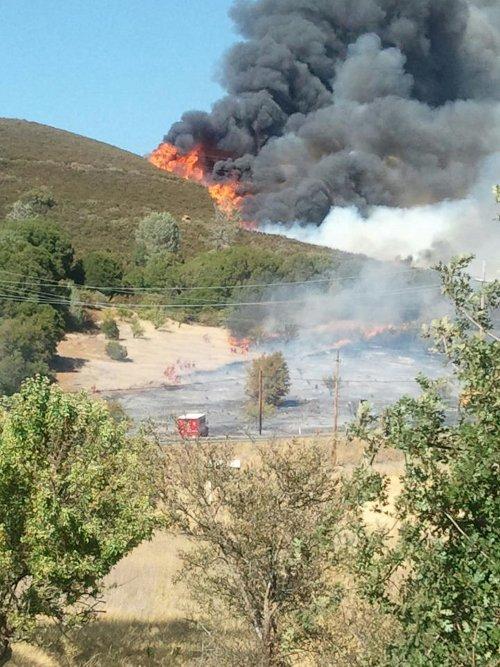
The Walker Fire, which had been reported shortly before the Wye, had reached 300 acres, according to Hutchinson.
It was burning in grass and oak woodlands, with a hot springs ahead if it, she said.
Earlier in the afternoon fire officials had reported that Wilbur Hot Springs had been evacuated, as had some areas inside the Colusa County line.
Air resources were hitting both fires aggressively from the air.
Reports from the scene indicated that the Walker Fire could get to 1,000 to 1,200 acres before it’s done.
Caltrans reported that Highway 20 between Highway 16 and Highway 53 was remaining closed Sunday evening due to the fires.
Additional updates will be posted as more information becomes available.
Email Elizabeth Larson at
- Details
- Written by: Elizabeth Larson
THIS STORY HAS BEEN UPDATED WITH ADDITIONAL DETAILS ABOUT THE INCIDENTS.
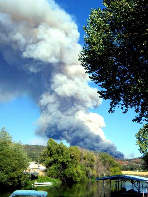
CLEARLAKE OAKS, Calif. – Two wildland fires were reported along Highway 20 east of Clearlake Oaks Sunday afternoon, causing a temporary highway shutdown order and resulting in evacuation orders for some nearby communities.
The fires, one near Walker Ridge and the second at the “Y,” the intersection of Highway 20 and Highway 53, were reported shortly before 4 p.m.
Shortly after 5 p.m., Cal Fire reported that the Walker Ridge fire had reached 35 acres and the “Y” fire was 75 acres.
Within a half hour, the “Y” fire was estimated to have hit 300 acres, with the potential to reach 1,000 acres by nightfall.
Northshore Fire, Cal Fire and Lake County Fire responded to the incidents, along with the California Highway Patrol and the Lake County Sheriff’s Office. A full wildland response was being sent to the Walker Ridge area, along with air resources.
Significant air resources – including an order for six air tankers and five helicopters – also were being sent to the “Y” area at Highway 20 and 53, where the fire had jumped and was on both sides of the roadway. A Cal Fire strike team from Mendocino County was being requested to respond, according to radio reports.
Structures were reportedly threatened in both areas, with at least one on fire, and at Highway 20 and Highway 53 vehicles also were in the path of the fire, with officials trying to evacuate vehicles from the area.
Radio reports had indicated a woman may have been trapped in her car in the fire’s path, but Northshore Fire Chief Jay Beristianos said she was able to escape.
At around 5 p.m. evacuations were ordered for the Old Long Valley Road and New Long Valley Road areas, as well as Wilbur Hot Springs and some other nearby areas in Colusa County, according to radio reports.
The evacuations were completed by about 5:30 p.m.
A short time later, evacuations were under way in Spring Valley, where ash from the fire was reported to be falling, according to a post on Lake County News’ Facebook page. Lake County Animal Care and Control also was on the way to assist with removing animals, according to reports from the scene.
Beristianos said power lines were down in multiple areas but that was to be expected due to the fire.
Caltrans said shortly after 6 p.m. that there was no estimated time of reopening for the stretch of Highway 20 between Highway 16 and Highway 53 that's closed due to the fires. The agency said it planned to issue an update on road conditions in the area on Monday morning.
This story will be updated as more information becomes available.
Email Elizabeth Larson at
- Details
- Written by: Elizabeth Larson
LOWER LAKE, Calif. – Community members gathered in front of Anderson Marsh’s beloved ranch house on Saturday morning to celebrate the 30th anniversary of the state historic park.
There was music by local performers, a big celebratory cake and recollections of what it took to create and sustain the park.
Many of the people who originally struggled to create the park – as well as those who in recent years have fought the battle to keep it open in the face of proposed state closures – were on hand to recount its history.
The park encapsulates several different epochs of Lake County’s rich cultural landscape.
As archaeologist Dr. John Parker – who first had the “pipe dream” to create a park on the land – explained, the park has the highest archaeological site density of any area in California, except for maybe the coast.
In more recent times, it came to represent one of the earliest examples of white settlement in the area, with John Grigsby and his brother building the first part of the ranch house in 1855.
“Anderson Marsh is a special place,” said Park Sector Superintendent Bill Salata, who oversees both Anderson Marsh and Clear Lake State Park.
Salata noted, “Anderson Marsh holds 10,000 years of cultural change.”
He said his goal is to keep the park open and put more staff time into the grounds.
Anderson Marsh Interpretive Association President Roberta Lyons said at the time of the park’s formation, news headlines credited local people for making it happen.
She said people are continuing to make it happen now with efforts to keep the park open.
The association has been in negotiations from several months with the California Department of Parks and Recreation to operate the park, which had been among 70 state parks slated for closure July 1.
Despite the recent disclosure that millions of dollars had been found in a hidden state fund, Lyons said the work to keep the park open needs to continue.
Parker, in his keynote address, recalled his work at Anderson Marsh beginning 40 years ago, when in 1972 he was a 19-year-old freshman at Sonoma State University with a passion for archaeology.
Over the next 10 years he would lead the area’s significant archaeological studies, nominate it successfully for the National Register of Historic Places, and find and document more than 50 archaeological sites on its 1,000 acres.
Some of those sites are 8,000 to 10,000 years old, Parker said, and were the center for the Koi people.
The effort to create the park survived lawsuits over the land, failed purchase attempts, a proposal for a cement channel to divert Cache Creek, a project that proposed a 1,000-home subdivision and changes in county leadership.
Parker would write numerous letters, make trips to Sacramento to meet with lawmakers and sit through exhausting daylong state budget sessions. It proved a nail biting experience to the end.
When the Lake County Planning Commission held its meeting on the proposed subdivision general plan amendment – which, had it been granted, would have pushed the property prices beyond the funds set aside to purchase the park – about 140 people showed up to speak against the project, which eventually was withdrawn, he said.
Parker said 3,000 people came to the park’s grand opening.
“A lot of people made it happen,” said Parker.
“This is an amazing place,” he added.
Creating a state park was one small part of the ultimate effort, he said.
There are many more critical steps since then, Parker said, including keeping it open and running.
Henry Bornstein, Anderson Marsh Interpretive Association’s treasurer, told Lake County News that the work to keep the park open is still under way, as negotiations with the state continue.
“So far everyone is saying yes,” he said, but added the final approval hasn’t yet been granted.
Two days before the anniversary celebration, Anderson Marsh Interpretive Association submitted to the state the final version of its proposal to run the park, according to Bornstein.
“I’ve just been amazed by the support we’re getting,” Bornstein said.
Email Elizabeth Larson at
- Details
- Written by: Lake County News Reports
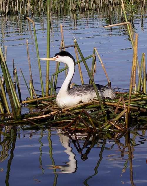
LAKE COUNTY, Calif. – For the second year in a row, the Redbud Audubon Society has set up a video camera on a small colony of nesting Western and Clark’s Grebes on Clear Lake.
The Webcam is broadcasting live video of grebes in courtship displays, building their floating nests on the water, and then patiently taking turns to sit on the nest while incubating their eggs.
A Google search for grebe Webcams suggests that this is the first time anywhere in the world that a Webcam has focused on a nesting grebe colony.
Redbud Audubon is conducting this public outreach as part of a four-year grant to educate recreational boaters, jet-skiers and water-skiers to avoid disturbing the grebe colonies during the summer breeding season.
Clear Lake has one of the largest number of breeding grebes in Northern California.
A day-long survey by local field biologists on July 24 around the 100-mile shoreline of Clear Lake counted 7,760 grebes and more than 1,800 nests in 13 colonies. This compares to 1,248 nests in 2011 and 1,322 in 2010.
To see the Webcam on a home computer or smartphone, visit the www.redbudaudubon.org Web site.
On the home page, click under the photo of a baby grebe riding on its parent’s back. It may take a few minutes for the video to load on the screen.
Generally, the video is transmitting about six hours a day, from roughly 10 a.m. to 6 p.m.
If the video does not come up during these hours, try again later, as there can be lapses in the transmission.
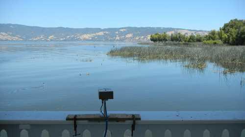
Six separate but connected electronic devices are required to capture and transmit the live video, and glitches can and do happen.
Redbud Audubon also created an article with many photos explaining about grebes and this conservation project.
Entitled “Those Amazing ‘Dancing’ Grebes,” the link to this new page on the Redbud Web site is just below the Webcam screen.
Two other Audubon chapters in Northern California – Altacal Audubon in Chico and Plumas Audubon in the Sierras – also are conducting this grebe education project on their local grebe breeding lakes.
Audubon California, the state office of the National Audubon Society, coordinates the work of the three chapters.
The grant is funded by the Luckenbach Trustee Council, with mitigation funds paid by the oil companies responsible for oil spills off the California coast that killed many Western and Clark’s Grebes.
The public education outreach is aimed at reducing human disturbance to the nesting grebes, thus increasing their breeding success.
As part of the grant project, Redbud has purchased speed buoys that the Lake County Department of Water Resources places around the floating colonies to alert boaters to avoid those areas.
A new sign was placed on the bridge at the entrance to Rodman Slough again warning boaters to slow to 5 miles per hour.
Later this year Redbud Audubon will place at four shoreline parks around Clear Lake an attractive interpretive sign explaining grebe nesting and the need to protect the vulnerable colonies.
“This project is a very special one for Redbud Audubon Society, as the Western Grebe has been the chapter logo since 1974 when the chapter was incorporated,” explained President Marilyn Waits.
“Everyone in Lake County – residents and visitors alike – is fascinated with watching the grebes on Clear Lake,” Waits added. “The Audubon Society is proud to be able to carry out this major effort to protect their nests, eggs, and young chicks.”