
Recreation
How do I find information on the backcountry stocking of trout?
Question: I have read in different places that CDFW at times stocks trout in the Sierra mountains and elsewhere in high country lakes – sometimes by airplane, horses and humans. Is there a web page on your site that discusses when and where this takes place? Is there a record showing when and where previous stockings took place? I have found the Fish Planting Schedule on your website but never see backcountry or high-elevation lakes included. (Ryan)
Answer: Great questions, Ryan. Let’s start with the Fish Planting Schedule on the California Department of Fish and Wildlife’s (CDFW) website. That schedule shows “catchable trout” – about 12 inches and larger – planted for recreational fishing. Those fish are planted to be caught more or less immediately by anglers, and the Fish Planting Schedule can help direct anglers to the fish.
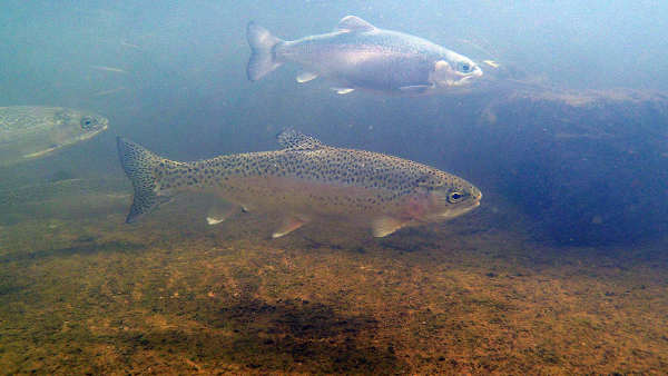
Trout stocked in backcountry waters, by contrast, are typically planted as “sub-catchables” or “fingerlings” which are typically 7 inches and smaller. Those trout plants don’t appear on the Fish Planting Schedule. Their smaller size makes the fish easier to transport to remote waters. They aren’t planted to be caught immediately – but rather the intention is that they grow and acclimate for a season or two and become much like wild fish by the time an angler encounters them.
There are a couple, better online resources for you. On CDFW’s Fish Planting Schedule web page there is a link to the Annual Provisional Stocking Document, which is the statewide overview of CDFW’s trout and inland salmon stocking plans for the fiscal year. These plants aren’t guaranteed – weather, fires, forest closures, hatchery problems and disease are among the factors that can alter or derail these plans. But it’s a comprehensive look at all the waters CDFW intends to stock along with detailed information on the species stocked and the size of the stocked fish. This document can be very helpful to those planning a backcountry fishing trip.
Another helpful resource is CDFW’s online Fishing Guide. Here you can search an area or specific body of water to see its fish planting history – including those trout stocked as fingerlings and sub-catchables. CDFW’s online Fishing Guide can also tell you what backcountry waters have trout in them and what species of trout you’ll likely find.
Some of the most enjoyable backcountry waters to fish are those that were planted long ago and now support wild, self-sustaining trout populations as a result. Backcountry trout are not stocked indiscriminately, but only after an environmental assessment is conducted to ensure the water is not home to any endangered frogs or other species that could be threatened by introduced trout. In some cases, non-native trout are removed from backcountry waters where they jeopardize native amphibian populations or inhibit recovery.
Each CDFW region is responsible for the stocking of its backcountry waters. Some rely on hatchery staff, volunteers on mules and horseback, aerial stocking or some combination of these methods. You are welcome to reach out to the appropriate CDFW regional office and speak with the local fisheries biologists about their backcountry trout stocking efforts.
Those CDFW regions most popular with trout anglers often have additional resources to share. CDFW’s Inland Deserts Region, for example, home to renowned trout fishing destinations in Inyo and Mono counties, has developed an “Eastern Sierra Back Country Fishing Guide” with a detailed account of the distribution of various trout species within its high elevation lakes. We wish you good luck in your backcountry fishing adventures. See CDFW’s Places to Visit page to see what activities are allowed on each department property.
Using maps to plan a hunt
Question: This is my first year hunting. I downloaded the X map. It tells me where the Bureau of Land Management (BLM) properties and private properties are, and I see the Fish and Wildlife properties. Can I hunt there? (Damian)
Answer: Assuming you’re talking about deer hunting, it sounds like you’re referring to onX maps, a GPS mapping program that offers information on property ownership. This is a well done (and not free) program that can be of great use to hunters, but it’s not necessary that you buy a map or mapping program for this information. You can check the websites of each agency to find properties where hunting is allowed.
For CDFW, you’ll find information on zones, regulations, licenses and much more on our website. Some of our CDFW-managed lands allow hunting and some don’t. There are different rules for hunting different game species. You’re expected to have a good understanding of where you can legally hunt before heading out.
Also consider reviewing CDFW’s regulation booklet for Waterfowl, Upland Game, Public Use of Department Lands. The section titled “Hunting and Other Public Uses on State and Federal Lands” addresses all types of authorized public uses. In particular, Section 551(e), “Types of Wildlife Areas,” provides guidance on which species are legal to hunt on each type of wildlife area. Section 551(e) will also alert you to which regulations to check for any exceptions to the general rules.
If you have a question for the California Department of Fish and Wildlife, email
- Details
- Written by: CALIFORNIA DEPARTMENT OF FISH AND WILDLIFE
NORTHERN CALIFORNIA – Mendocino National Forest offices have returned to Phase 0 in line with the State of California stay at home order.
Offices are closed to the public and all services are offered online.
Maps, passes and recreation permits are available here: https://store.usgs.gov/.
If you previously obtained a Christmas tree permit or personal free-use firewood permit, please remember that Christmas tree permit holders can cut their tree any day of the week through Thursday, Dec. 24, 2020, and firewood permits expire Thursday, Dec. 31, 2020.
August Complex and Ranch Fire Forest Order 08-20-15 and signs are posted at all the campgrounds, information kiosks, affected recreation sites, trailheads and the forest website.
This order lists campgrounds and trails that are closed due to fire impacts. Remember that there are many hazards present within the Ranch Fire and August Complex fire areas, such as fire weakened trees, burned stump holes, rolling debris and potential landslides and flooding.
Dispersed camping and recreation sites not listed in the closure order remain open to the public. More information about dispersed camping is https://www.fs.usda.gov/activity/mendocino/recreation/campingcabins/?recid=25120&actid=34.
Until snow prevents travel across the forest, roads are open as designated on the Motor Vehicle Use Map: https://www.fs.usda.gov/detail/mendocino/mapspubs/?cid=FSBDEV3_004435.
Whether heading out to the forest to cut a Christmas tree, gather firewood or enjoy some snow play, please check the forecast and be prepared for changing weather and road conditions. Carry emergency equipment in vehicles and remember there may be no cell phone coverage.
Please call 530-934-3316 for more information.
- Details
- Written by: Elizabeth Larson


 How to resolve AdBlock issue?