How to resolve AdBlock issue?
Refresh this page
How to resolve AdBlock issue?
Refresh this page
Lake County News,California
  • Home
    • Registration Form
  • News
    • Community
      • Obituaries
      • Letters
      • Commentary
    • Education
    • Veterans
    • Police Logs
    • Business
    • Recreation
    • Health
    • Religion
    • Legals
    • Arts & Life
    • Regional
  • Calendar
  • Contact us
    • FAQs
    • Phones, E-Mail
    • Subscribe
  • Advertise Here
  • Login
How to resolve AdBlock issue?
Refresh this page
How to resolve AdBlock issue?
Refresh this page

News

Fires pose growing worldwide threat to wildland-urban interface areas

Scientists construct global maps of burned areas at edge of cities


Fires that blaze through the wildland-urban interface, or WUI, are becoming more common around the globe, a trend that is likely to continue for at least the next two decades, new research finds.

The research team, led by scientists at the U.S. National Science Foundation National Center for Atmospheric Research, or NSF NCAR, used satellite observations and machine learning techniques to produce a unique database of WUI areas and fires worldwide, dating back about two decades.

The overall number of all fires worldwide has declined, as has the total area burned.

However, the scientists found that the fraction of global fires that occur in WUI areas increased by about 23% from 2005 to 2020. Even more significantly, the global area burned by WUI fires during the same time increased by about 35% as a fraction of all burned areas.

The research found that WUI areas are expanding worldwide, especially in rapidly urbanizing regions in Africa. As newly constructed developments move into areas of wild vegetation, the risk of fires increases. The paper did not focus on the role of climate change, although the authors said the database can help scientists better fingerprint the role of climate change in fires.

WUI areas are generally defined as the location where urban land use and wildland vegetation come into contact or intermingle. Fires in such areas are especially dangerous, both because they imperil large numbers of people and structures and because, by burning manufactured materials instead of vegetation, they emit far more toxins than forest and grassland fires.

“Wildland-urban interface fires are a major concern for many people in the United States and globally, and through this study we now know they have increased in recent years and will likely continue doing so in the future,” said NSF NCAR scientist Wenfu Tang, the lead author of the new paper. “This is important as a first step to looking at emissions from these fires and their impacts on human health.”

Funding for the research came from NOAA. The study was published in Environmental Research Letters.

Constructing a global database

WUI fires have caused catastrophic destruction in recent years, sometimes burning down thousands of buildings and killing 100 or more people.

Especially destructive fires include the 2009 Black Saturday bushfires in Australia, which left 173 dead, and the 2017 Pedrosa Grande Fire in Portugal, which killed 66 people.

Last year’s Lahaina Fire in Hawaii was the deadliest in the United States in more than a century, killing 100 people and destroying more than 2,200 structures.

To understand more about trends in WUI fires, Tang and her colleagues turned to a global high-resolution map of WUI fires in 2020, which had been created by Franz Schug of the University of Wisconsin-Madison.

They also analyzed data about Earth’s surface from NASA’s Moderate Resolution Imaging Spectroradiometer, or MODIS, satellite instrument.

By applying machine learning techniques to the map and satellite data, they quantified the relationship of fires with such variables as land cover and population density. They then used those quantitative relationships to generate a global database of WUI areas and WUI fires, going back 20 years at a resolution of 9 kilometers (5.6 miles).

The researchers successfully confirmed the accuracy of the database by comparing it with independent WUI datasets previously developed for a few years within the same time period, including for the continental United States and globally.

In analyzing the new database, the researchers found that WUI areas have grown in all populated continents by 24% from 2001 to 2020, with the largest increase occurring in Africa.

Largely as a result, fires in WUI areas have also become more common. Since 2005, they have increased from 3.5% to 4.3% of all fires. In North America, the WUI fraction of all fire counts is even higher (up to 9%), with WUI fires in 2015-2020 becoming particularly large and more destructive.

“This is the first map of its kind that enables us to look at how WUI fires have been evolving globally over the past two decades,” said NSF NCAR scientist Cenlin He, a co-author of the study. “It shows that WUI fires have increased on every populated continent.”

Even as WUI blazes loom as a greater threat, the scientists noted that fires overall have been on the decline. Since 2005, the total number of fires worldwide decreased by 10%, and the amount of burned areas decreased by 22%, according to satellite observations analyzed in their research.

Tang and her colleagues then turned to the future. They integrated the WUI database with the NSF NCAR-based Community Earth System Model, which simulates global climate and fires, to determine the likely trends in WUI fires through 2030 and 2040.

If WUI areas continue to expand and greenhouse gases continue to be emitted at a high rate, they found that the WUI fraction of burned areas worldwide will likely increase by about 2.6-3.2% by 2040. However, the picture can change somewhat depending on changes in WUI areas and greenhouse gas emissions under different future scenarios, according to their analysis.

“This study is an important step in quantifying WUI fires and how they are changing worldwide,” Tang said. “As WUI areas rapidly expand and WUI fires become more frequent, it is critical to understand the interactions between WUI fires and human activities as well as the impacts of the fires on air quality, human health, and the environment.”
Details
Written by: U.S. National Science Foundation National Center for Atmospheric Research
Published: 22 April 2024

Removing PFAS from public water systems will cost billions and take time – here are ways you can filter out harmful ‘forever chemicals’ at home


PFAS are showing up in water systems across the U.S. Jacek Dylag/Unsplash, CC BY

Chemists invented PFAS in the 1930s to make life easier: Nonstick pans, waterproof clothing, grease-resistant food packaging and stain-resistant carpet were all made possible by PFAS. But in recent years, the growing number of health risks found to be connected to these chemicals has become increasingly alarming.

PFAS – perfluoroalkyl and polyfluoroalkyl substances – are now either suspected or known to contribute to thyroid disease, elevated cholesterol, liver damage and cancer, among other health issues.

They can be found in the blood of most Americans and in many drinking water systems, which is why the Environmental Protection Agency in April 2024 finalized the first enforceable federal limits for six types of PFAS in drinking water systems. The limits – between 4 and 10 parts per trillion for PFOS, PFOA, PFHxS, PFNA and GenX – are less than a drop of water in a thousand Olympic-sized swimming pools, which speaks to the chemicals’ toxicity. The sixth type, PFBS, is regulated as a mixture using what’s known as a hazard index.

Meeting these new limits won’t be easy or cheap. And there’s another problem: While PFAS can be filtered out of water, these “forever chemicals” are hard to destroy.

My team at the University of Notre Dame works on solving problems involving contaminants in water systems, including PFAS. We explore new technologies to remove PFAS from drinking water and to handle the PFAS waste. Here’s a glimpse of the magnitude of the challenge and ways you can reduce PFAS in your own drinking water:

Removing PFAS will cost billions per year

Every five years, the EPA is required to choose 30 unregulated contaminants to monitor in public drinking water systems. Right now, 29 of those 30 contaminants are PFAS. The tests provide a sense of just how widespread PFAS are in water systems and where.

The EPA has taken over 22,500 samples from about 3,800 of the 154,000 public drinking water systems in the U.S. In 22% of those water systems, its testing found at least one of the six newly regulated PFAS, and about 16% of the systems exceeded the new standards. East Coast states had the largest percentage of systems with PFAS levels exceeding the new standards in EPA tests conducted so far.

Under the new EPA rules, public water systems have until 2027 to complete monitoring for PFAS and provide publicly available data. If they find PFAS at concentrations that exceed the new limits, then they must install a treatment system by 2029.

How much that will cost public water systems, and ultimately their customers, is still a big unknown, but it won’t be cheap.

The EPA estimated the cost to the nation’s public drinking water systems to comply with the news rules at about US$1.5 billion per year. But other estimates suggest the total costs of testing and cleaning up PFAS contamination will be much higher. The American Water Works Association put the cost at over $3.8 billion per year for PFOS and PFOA alone.

There are more than 5,000 chemicals that are considered PFAS, yet only a few have been studied for their toxicity, and even fewer tested for in drinking water. The United States Geological Survey estimates that nearly half of all tap water is contaminated with PFAS.

Some money for testing and cleanup will come from the federal government. Other funds will come from 3M and DuPont, the leading makers of PFAS. 3M agreed in a settlement to pay between $10.5 billion to $12.5 billion to help reimburse public water systems for some of their PFAS testing and treatment. But public water systems will still bear additional costs, and those costs will be passed on to residents.

Next problem: Disposing of ‘forever chemicals’

Another big question is how to dispose of the captured PFAS once they have been filtered out.

Landfills are being considered, but that just pushes the problem to the next generation. PFAS are known as “forever chemicals” for a reason – they are incredibly resilient and don’t break down naturally, so they are hard to destroy.

Studies have shown that PFAS can be broken down with energy-intensive technologies. But this comes with steep costs. Incinerators must reach over 1,800 degrees Fahrenheit (1,000 Celsius) to destroy PFAS, and the possibility of creating potentially harmful byproducts is not yet well understood. Other suggested techniques, such as supercritical water oxidation or plasma reactors, have the same drawbacks.

So who is responsible for managing that PFAS waste? Ultimately the responsibility will likely fall on public drinking water systems.

The EPA on April 19, 2024, designated PFOA and PFOS as eligible contaminants for Superfund status, which means companies that are responsible for contaminating sites with those chemicals can be required to pay for cleanup. However, the EPA said it did not intend to go after wastewater treatment plants or public landfills.

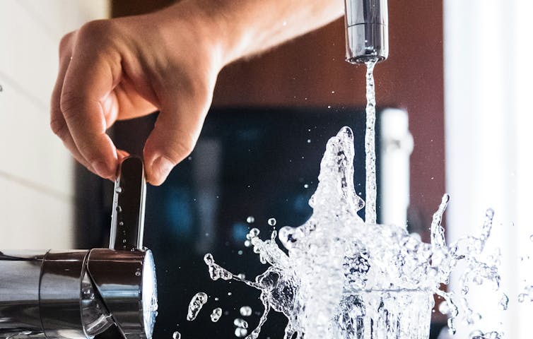
Steps to protect your home from PFAS

Your first instinct might be to use bottled water to try to avoid PFAS exposures, but a recent study found that even bottled water can contain these chemicals. And bottled water is regulated by a different federal agency, the Food and Drug Administration, which has no standards for PFAS.

Your best option is to rely on the same technologies that treatment facilities will be using:

  • Activated carbon is similar to charcoal. Like a sponge, it will capture the PFAS, removing it from the water. This is the same technology in refrigerator filters and in some water pitcher filters, like Brita or PUR. Note that many refrigerator manufacture’s filters are not certified for PFAS, so don’t assume they will remove PFAS to safe levels.

  • Ion exchange resin is the same technology found in many home water softeners. Like activated carbon, it captures PFAS from the water, and you can find this technology in many pitcher filter products. If you opt for a whole house treatment system, which a plumber can attach where the water enters the house, ion exchange resin is probably the best choice. But it is expensive.

  • Reverse osmosis is a membrane technology that only allows water and select compounds to pass through the membrane, while PFAS are blocked. This is commonly installed at the kitchen sink and has been found to be very effective at removing most PFAS in water. It is not practical for whole house treatment, but it is likely to remove a lot of other contaminants as well.

If you have a private well instead of a public drinking water system, that doesn’t mean you’re safe from PFAS exposure. Wisconsin’s Department of Natural Resources estimates that 71% of shallow private wells in that state have some level of PFAS contamination. Using a certified laboratory to test well water for PFAS can run $300-$600 per sample, a cost barrier that will leave many private well owners in the dark.

For all the treatment options, make sure the device you choose is certified for PFAS by a reputable testing agency, and follow the recommended schedule for maintenance and filter replacement. Unfortunately, there is currently no safe way to dispose of the filters, so they go in the trash. No treatment option is perfect, and none is likely to remove all PFAS down to safe levels, but some treatment is better than none.

This article, originally published April 17, 2024, has been updated with EPA’s Superfund declaration.The Conversation

Kyle Doudrick, Associate Professor of Civil and Environmental Engineering and Earth Sciences, University of Notre Dame

This article is republished from The Conversation under a Creative Commons license. Read the original article.

Details
Written by: Kyle Doudrick, University of Notre Dame
Published: 22 April 2024

April is Alcohol Awareness Month: Statewide program helps ABC licensees stay in compliance

In observance of Alcohol Awareness Month, the California Department of Alcoholic Beverage Control, or ABC, is highlighting a statewide program aimed at helping licensees stay in compliance and reduce alcohol-related crime.

Informed Merchants Preventing Alcohol-Related Crime Tendencies, or IMPACT, works to enhance safety in local communities.

Through this program, inspections of licensed premises are conducted to identify instances of non-compliance.

Licensees are given an opportunity to correct violations to come into compliance before ABC initiates enforcement action.

“IMPACT’s goal is to work with licensees to reduce conditions that could lead to alcohol-related crime,” ABC Director Joseph McCullough said. “Addressing problems such as litter, graffiti, and loitering increase public safety and improve the quality of life in and around the licensed premises.”

The IMPACT program reminds licensees of the responsibilities and accountability associated with selling alcoholic beverages by identifying areas of non-compliance and providing crime prevention information before conducting follow-up visits to ensure correction.

Many local communities have worked with ABC to conduct business inspections. IMPACT can improve the relationship between law enforcement and merchants.

ABC and local law enforcement agencies conducted 1,061 IMPACT inspections from July 2023 to March 2024.

Funding for the IMPACT program is provided by a grant from ABC through the department’s Alcohol Policing Partnership program.
Details
Written by: Lake County News reports
Published: 22 April 2024

California State Parks encourages all to celebrate Earth Day

Anderson Marsh State Historic Park in Lower Lake, California. Photo courtesy of Anderson Marsh Interpretive Association.

LAKE COUNTY, Calif. — Celebrate Earth Day this month with California State Parks at any of the 280 unique park units across the state. State Parks has numerous Earth Day-themed events planned.

They include in-person activities such as guided walks and hikes, workdays, and a bioblitz, as well as virtual programming with a live dive broadcast exploring the hidden world of the ocean.

Opportunities to explore and enjoy the outdoors are available at Clear Lake State Park in Kelseyville and Anderson Marsh State Historic Park in Lower Lake.

“I’d like to invite all Californians to get out and enjoy the outdoors this Earth Day,” said California State Parks Director Armando Quintero. “California includes some of the most diverse and extraordinary landscapes in the world. Take time to discover where you live!”

A list of statewide Earth Day events for departments, conservancies, and commissions under the California Natural Resources Agency is available at resources.ca.gov/EarthDay2024.

While Earth Day is Monday, April 22, it is being celebrated all weekend long. Here are some of the in-person and virtual Earth Day events being held at state park units:

State Parks looks forward to seeing Californians on trails, beaches, mountains, and the deserts on Earth Day, but asks for all to please recreate responsibly:

Know Before You Go: Prior to leaving home, check the status of the park unit you want to visit to find out what restrictions and guidelines are in place, and to find out if your destination may be temporarily closed. Have a backup plan in case your destination is crowded.

Play It Safe: Find out what precautions you should take when exploring the outdoors, especially if this is your first time visiting the State Park System. For example, make sure to dress in layers, bring plenty of snacks and water, and wear appropriate hiking shoes.

Leave No Trace: Leave areas better than how you found them by staying on designated trails and packing out all trash. Do not disturb wildlife or plants.

Download Mobile App: Visitors are invited to download the California State Parks mobile app, which allows users to download park unit maps and receive up-to-date information on any trail closures and events. Powered by OuterSpatial, the app has park information, route details, and virtual badges you can collect as you visit parks. Visitors can download the app here.

Don’t Doom the Bloom: If you plan on visiting a park to view wildflower blooms, make sure to first visit the Wildflower Bloom webpage for up-to-date information on the blooms and tips to safely and responsibly view them.

California’s state park system has 280 state park units, over 340 miles of coastline, 970 miles of lake and river frontage, 15,000 campsites, 5,200 miles of trails, 3,195 historic buildings, and more than 11,000 known prehistoric and historic archaeological sites. Plus, there are also many other local and national parks across the state that Californians can enjoy on Earth Day and year-round.

Looking up at Calaveras Big Trees State Park. Photo courtesy of California State Parks.
Details
Written by: Lake County News reports
Published: 21 April 2024
  1. Thompson votes to support supplemental package for key national security priorities
  2. Caring for older Americans’ teeth and gums is essential, but Medicare generally doesn’t cover that cost
  3. Helping Paws: Shepherds, retrievers and mastiffs

Subcategories

Community

  • 701
  • 702
  • 703
  • 704
  • 705
  • 706
  • 707
  • 708
  • 709
  • 710
How to resolve AdBlock issue?
Refresh this page
Copyright © 2026 Lake County News,California. All Rights Reserved.